2018. január 7.
The Bouvet Island DXpedition
Tájékoztató:
Egy rövid tájékoztató a Bouvet projectről.
Kedden, 9.-én indolok a Bp-Amsterdam-Santiago-Punta Aréna útvonalom. A találkozási pont Punta Aréna, Jan. 10.-én. Itt két nap kötelező biztonságtechinkai képzés és tréning, majd 13.-án reggel repülünk King George Island (South Shetland Islands Antarctica). Ez a behajózási pont. Ezzel megússzuk a hajózást a Drake átjárón és spórolunk 2-3 nap napot. King George Islandon egy rövid látogatás az Orosz Bázison majd délután behajózás és indulás Bouvet-ra. Sajnos a tenger jegesedése és a nagyon sok jéghegy miatt előbb 1-2 napig északnak kell vennünk az irányt elkerülendő a jéghegy veszélyt. A hajóút kb 10-11 nap a Déli óceán „csendes” vizein. Érkezés Bouvera kb 22-23.-án. Várhatóan, ha az időjárás is úgy akarja, 25.-étől várhatóak vagyunk a sávokon.
18 + 2 állomás kerül telepítésre, minden sávon két állomás plusz 6 m és 2 m EME. Négy órás váltásokban dolgozunk, 7/24, három héten keresztül. Nincs lehetőség HA QRG-re vagy egyéb csalafintaságra, kérem megértéseteket. Amit ígérni tudok az a gyárilag beépített bio HA filter. Ha meghallok egy HA állomást, nem hagyom ott, nem hagyom lenyomni, kitartok mellette amíg logba kerül. Maradok a QRG-n ezt követően egy rővid ideig, hátha más HA is megtalálta az RX frekimet. Segítsétek egymást infóval. Nem kis nyüzsi várható. Nem lesz SZIA, 73 csak egy pity-pity a sikeres HA QSO végén. Ha ez esetleg elmarad, nem jelenti azt, hogy nincs a logban. Kérlek benneteket, ti se adjatok sziát vagy 73-mat, még ha tudjátok is hogy én vagyok az op. Mutassatok egy kis stílusgyakorlatot a világnak, hogyan kell a pile-upban sikeresen, fegyelmezetten rádiózni. Csak egyszer adjátok a hívójeleteket, majd figyel, ahogy szoktátok.
A döglött sávok sem reménytelenek. FT8-ban ott is lehet esély. Kérlek olvassátok a honlapon az FT8-ra vonatkozó információt. Ne adjatok lokátort. felesleges. Kövessétek az FT8-ra vonatkozó a honlapon található javaslatot.
ZL2IFB honlapja magyarul HA5OT fordításában: http://www.ha5mrc.hu/download/digimodes-ha5ot.html
http://www.bouvetdx.org/band-plan-frequencies/
Segítsétek egymást, nyissatok esetleg egy chat felületet.
Remélem minél több HA állomás kerül a logba. Találkozunk a pile-up-ban.
73, Pista, HA5AO
=ooo=
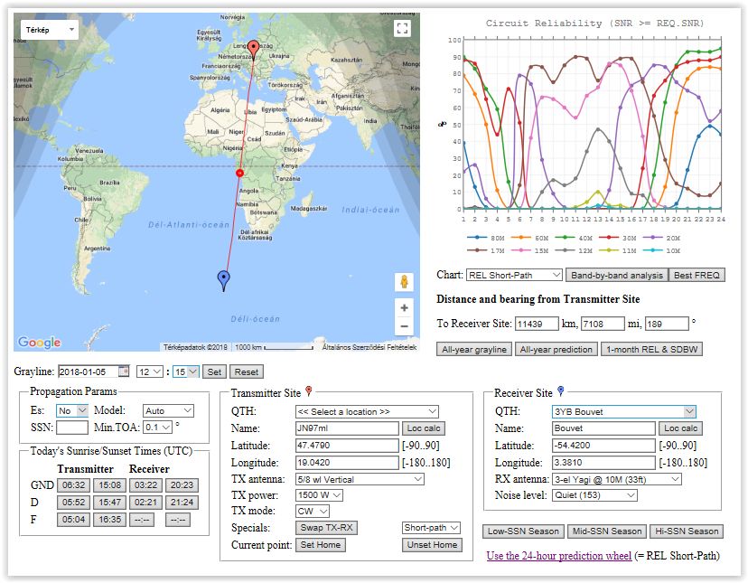
A terjedési lehetőségek előrebecslése a VOACAP és a NOAA adatok felhasználásával:
Bármely két pont között használható, ha az egyik. pl. a piros színű jelölőt az egyik QTH helyére húzzuk, a másikat az ellenállomás települési helyére.
A LOC vagy a földrajzi koordináták a táblázatban pontosíthatók, ill. a DXCC listából választhatók.

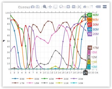
Ha ezt majd akkor beállítod, amikor már működik az expedíció, akkor a jobb felső sarokban látható grafikonon húzogatva az egérkurzort százalékosan mutatja az összeköttetés valószínűségét -sávonként.
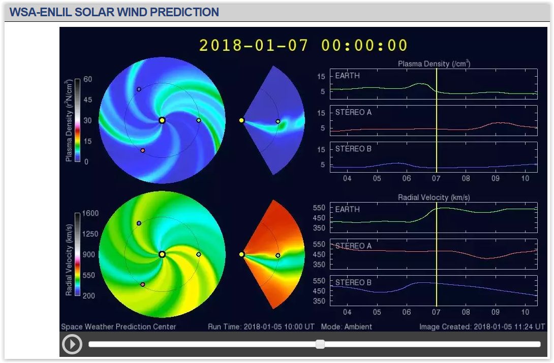
Az egész kalkulációt felülírhatja a napszél hatása az adott időpontban, ami innen van:
http://www.swpc.noaa.gov/products/wsa-enlil-solar-wind-prediction
Itt el kell indítani a "magnót" ami betölti az adatokat, s utána a kívánt naphoz/órához húzni a mutatót és akkor látod, hogy milyen sűrű az "áldás", ami éppen a napszéllel érkezik.
Most pl. úgy látszik, hogy január 7-én nem lesz zavaró a napszél sebessége, ill. az érkező részecskék sűrűsége.
nn
K4M
KH1 Baker Island Announcement
K1N
https://t-rexsoftware.com/k1n/main.htm
PT0S
The stations stopped at 10:17 UT on 23rd November, 2012. The crew has arrived home safely by the end of the month.
According to some comments, PT0S my be chosen the DXpedition of the year.
You can find a summary of their outstanding achievement at http://pt0s.com/PT0S_Summary.pdf
For pictures and more information you may visit their website.
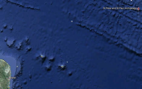
Voyage map of PT0S team:
=ooo=
HA7RY and his mate AA7JV with two Brazilians is on the deck of a small ship heading towards Saint Peter and Paul Rocks to start PT0S operations tomorrow evening, on 10th November, 2012.
You can see the rocky site of the station in Google Earth.
Visit http://pt0s.com/
http://dx-world.net/2012/pt0s-st-peter-and-st-paul-rocks/
C6AGU
The well known crew of TX3A and other successful DXpeditions are in action again. They have just appeared on zhe (lower) bands and prepare for the week-end CQ World Wide160-Meter Contest.

ZA3HA
We are busy packing. Destination: Orikum/Radhime Beach in Albania! We plan to work in the CQ WW DX contest in a multi-operator category. Operators are members of Haros Radioklub (HA5HRK) and on the spot we will be joined by some Albanian radio HAMs.
Visit: http://www.za3ha.com/
YJ0HA Vanuatu
Please be informed, that we went QRT after 12 days of operation on 14 November 2010 at 01:12 UTC (12:12 local time). We made 14 181 QSOs, excluding dupes, from 119 DXCC entities. You can see more detailed statistical figures on the log search page. The complete log are on-line and it has also been uploaded to the LotW.
All the QSO clarification request we received by e-mail, will be answered after arrival back home.
Thank you for the contacts and please accept our sincere apologies if we were not able to pick your callsing up in the pile-up.
Special thanks to our wifes for their kind help and support making our opearation more comfortable. Thank you for their patient and for their kind understanding, if we paid more attention to the operation than to them.
73, Pista (HA5AO) and George (HA5UK), the crew of YJ0HA
RSGB Convention - 9-10 Oct 2010
HA7RY and HA5X were guests of RSGB Convention 2010.
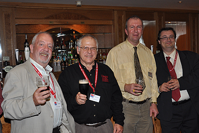
Pre-Dinner drinks: Colin G3PSM, Tomi HA7RY (of the excellent TX3A Chesterfield operation), Max M0GHQ and Chris HA5X.
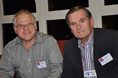
Tomi HA7RY with GM-DX Group Chairman Rob GM3YTS. Rob had presented Tomi HA7RY with a GM-DX Quaich at Ham Radio.
Source: http://g3txf.com/dxtrip/HFC-Oct-10/HFC10.html
Lecture about TX3A DX-pedition in Sweden
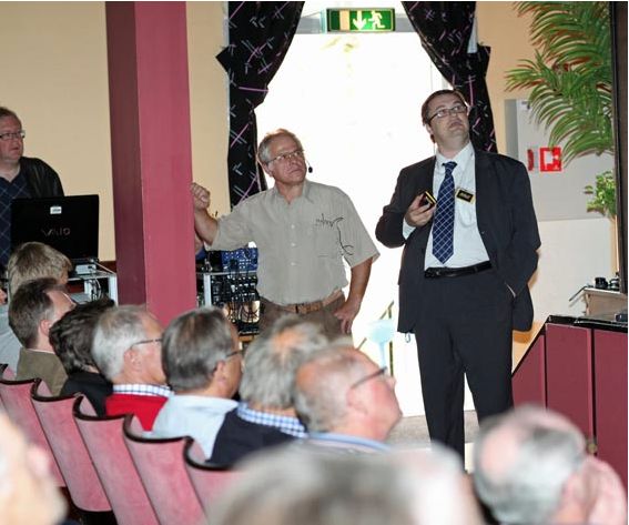
Standing (left to right) HA7RY and HA5X commenting their presentation.
The crew of TX3A was presented with GM-DX Quaich Trophy in Friedrichshafen
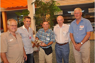
10th June, 2010.
Story of TX3A DXpedition
https://tx3a.org/documents/TX3Astory.pdf
Lesotho, Africa
HA5AO is expected to start sending reports from Lesotho as 7P8AO tomorrow, on 29th August 2009.
Visit:
Corall Islands, Australia
The next planned DXpedition by AA7JV and HA7RY is to be active from Chesterfield Islands, near New Caledonia beginning with 23rd November until 6th December, 2009..
Callsign in use will be TX3A and FK/AA7JV vagy FK/HA7RY. Their main goal is to activate
the lower HF-bands.


The website of the expedition:

https://dxexpeditions.com/tx3a/
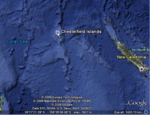
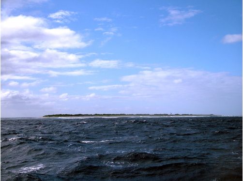
Photo credit: Gary Chen
Newspaper cutting from a Japanese ham radio magazine:
VK9GMW: The Mellish Reef DXpedition
By George Wallner, AA7JV
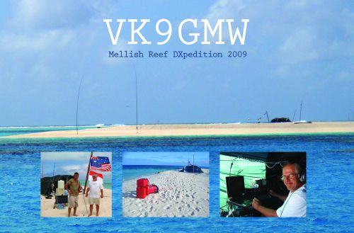
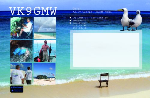
DXpedition! …The word brings up the images or adventure and radio. And that is exactly what we got on our Mellish Reef DXpedition. A lot of adventure, and a lot of radio.
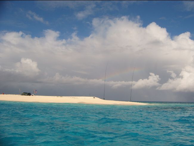
This was going to be a small and simple DXpedition. Just two guys: Tomi, HA7RY, and me. We would have a single station, one tent, only one TX antenna and one 1.5 kVA generator. We would have a dual SG-500 solid state PA with 800 watts output. Everything had to be light and easy to work with. At the same time, we wanted to focus on the low bands – especially on 160 meters – which normally requires large antennas and plenty of power. As it turned out, out biggest challenge would be the distance and the weather.
We have done similar things before: we went to Willis Islets in 2007 (VK9WWI), the Bahamas and Bajo Nuevo in 2008 (C6AGU and 5K0T). But Mellish Reef is twice as far and was going to be much more difficult.
Timing was also going to be a problem. We wanted to be on Mellish Reef early enough to have good 160 meter conditions, but not so early that we would get caught in a cyclone (typhoon), whose season ends sometimes in early April. As it turned out, we had to ride out Cyclone Jasper on Marion Reef. The cyclone hit Mellish and Chesterfield Reefs just about the time we were supposed to arrive on Mellish. Fortunately, Jasper was the last cyclone of the season.
Mellish Reef is an 8 km long narrow coral reef with a small cay in the center. The cay is about 700 meters long and 100 meters wide. Its highest point is 1.5 meters above the high tide water line. The cay is inhabited by birds (lots of birds) and hermit crabs. Underwater, there are huge coral walls and coral heads that go from 50 meters to the surface vertically. Mellish Reef is 1000 kilometers form the Australian mainland. Because of its exposed position, Mellish is constantly battered by storms and huge waves. Winds tend to be strong most of the time.
We would travel to Mellish Reef on our own boat, the 17 meter motor vessel Pedro, which was left to me by my late friend Peter Owen. This is a strong boat, originally built as a high-speed search and rescue craft, but not designed for long ocean voyages. She is only 17 meters long and does not have the fuel range: we would need almost twice as much fuel as her tanks can hold! To solve this problem we bought bladder fuel tanks that we would carry on deck. That caused a new problem: the added weight caused the boat to ride so low in the water that her exhausts were under water. We had to take off a lot of “unnecessary” gear: the extra chain, extra ropes and the spare anchor; all important safety gear. No matter what, we would have to be very careful with fuel. We were going to have less than 10% reserve.
Despite all these problems, we were ready by March 16. We topped up the fuel tanks, and departed Airlie Beach in the late afternoon. Our first stop was going to be the beautiful Whitsunday Islands, only about 50 km away. Early next morning we raised the anchor and set out on our 950 km journey to Mellish. Our intention was to stop at Marion Reef, which lies at the half way point to Mellish. The wind was brisk and there was a moderate chop as we were winding our way through the coral towards one of the gaps in the Great Barrier Reef (GBR). We would have to make it through that gap to reach open waters. Until we were in open waters, we would have to be on constant alert for coral heads that can come from 30 meters to the surface vertically and pose a serious danger to any boat.
As we left the protection of GBR behind, which was around 4 PM, we were faced by the huge waves of the open Coral Sea. It was soon night, and although we could no longer see the waves, we could certainly feel them: they were rolling and pitching the boat violently. They also caused the fuel bladder on the bow to come lose. The big waves crashing over the bow made tying the tank back in place both difficult and dangerous. After a rough night, we finally reached Marion Reef around noon the next day. Winds were increasing but soon we were behind the reefs, which cut down the waves substantially. We anchored and had a well deserved dinner and a good nights’ sleep. By next morning the weather has deteriorated further. The weather forecasts indicated a low pressure system developing to our east. Although we were not in immediate danger, we had to delay our departure until the winds eased and the low either moved away or dissipated. Instead, the winds increased and we had to relocate to a better protected part of the reef, which unfortunately was further to the south and cost us some fuel to get to. We waited for the weather to improve: finally the low dissipated, but now the winds were almost gale force. We were getting impatient and we were using up our food and fuel, all of which were carefully calculated and just enough for the planned operation. We started spear-fishing to supplement our food supplies and we cut down on the generator usage to save fuel. After three days the weather appeared to improve and we decided to relocate to our first location as that was much closer to the gap in the coral that we would have navigate through on our departure for Mellish. Unfortunately, by next morning, the weather was bad again and we had to retrace our route back to the better protected section of the reefs. And then a real disaster: when trying to free the anchor from the coral, the entire bow pulpit broke off. Bang, just like that, it was gone, hanging down on the anchor chain. The bow pulpit is the front part of the boat that holds the anchor, something that would have to be in good shape for anchoring on Mellish Reef for two weeks! Fortunately the anchor broke free of the coral and we were able to raise the chain somewhat, launch the dingy and take the anchor and the broken pulpit off the chain. While the boat was adrift, we worked to build a temporary anchor holder and chain guide. We used parts of the antenna base to create a roller and parts of one of the fuel bladder holders (by now the bladder was empty) to create a make-shift set up that would at least allow us to anchor. We completed the work and were able to anchor again late that afternoon. The next nasty surprise was a new tropical low, which later developed into Tropic Cyclone Jasper, at that time about 100 km east of Mellish Reef. Initial forecasts gave no clear idea of its future movements, some suggesting that it will go east, while some were indicating it re-curving in towards us. A tropical cyclone is very dangerous at sea and a 17 meter boat has a very small chance of surviving it. At this point we were planning our escape back to the mainland, should the cyclone come towards us. Needless to say, we did not sleep well that night; getting up to check the forecast every four hours. Fortunately, after two days of uncertainty, it was becoming clear that Jasper was heading south-east and away from us. The weather also changed: the skies became clearer and one could feel that the cyclone season was over. Unfortunately, winds continued blowing hard, sometimes at over 60 km/h (30 kts), creating huge waves, which we could see just on the other side of the reef. Under these conditions departure for Mellish would be too dangerous. Well, at least we no longer had to worry about the cyclone, and we decided to wait; wait however long it would take for the winds to ease and the seas to lay down. We were working MM from the boat, but that was not the real thing. The wait was frustrating. Then on March 24 we saw the weather forecast suggesting some easing of the winds on the 25th and 26th. The morning of the 25th winds were still over 50 km/h and we decided to sit tight. On the morning of the 26th I measured the wind at 6 AM and it was down to 40 km/h and we decided to go. When we cleared the reefs into open water we were astonished to see some huge waves coming at us. These waves, which were at least 6 meters tall, were fortunately long, stretched out and posed no great danger. Still, scary and uncomfortable…they kept rolling us for 30 more hours. Around 2 PM next day we first saw a thin line on the horizon: the cay on Mellish Reef. It grew as we got closer and by three o’clock we could see that it was about a 2 meter high sand cay with some thin green vegetation on the top. Unfortunately, we could also see all that is was surrounded by dense coral. Coral is extremely dangerous to a boat, as even the smallest brush against it will destroy the propellers. On Mellish Reef, 1000 km from the shore, you are on your own and can not afford an accident like that. Therefore it took us some time to carefully work our way close to the island. We finally managed to anchor in relative safety about 500 meters from the island around 5 PM. We were all anxious to set foot on Mellish so we launched the dingy and reached the shore just before sunset. We had enough time to survey the island and decide where to locate the antennas and the tent. We would start setting up the station early next morning.
The antenna is key to a good signal. An amplifier can make a 10 dB difference. The difference between a good antenna and a bad one can be 20 dB (or more). In our case, the antenna had to work well on all bands. The critical ingredient on an island DXpedtion is the salt water. It provides a near perfect ground and allows for very low angles of radiation. A vertical standing in salt water can be very efficient. The antenna, however, should stand in the water, or at least have water under it (under the sand). This is critical. The belief that a vertical will be as good if it can “see” the water, is simply false. Sure, having salt water a few wavelengths away will help, but signals will be down by many dB-s because of ground losses. So we surveyed the area very carefully to find a location where we could stand the antenna in the water and get the maximum radiation towards the east, north and west.
There are serious challenges when installing an antenna in the sea. Tides will vary its feed-point impedance, waves will batter its base, the sea will try to flood it at high tide; and of course, everything must be water-proof and corrosion resistant. I know of DXpeditions that moved their antennas away from the water: they did not like them getting wet and salty, or getting washed away by the waves. With us, it is the opposite: we put the antennas as far into the water as we possible and are prepared to deal with all the problems and challenges that are inherent in such a location.
The key to our antenna system is a home built, water-proof, dual output automatic antenna coupler (the coupler has two antenna ports with an internal ANT select relay). The coupler solves the problem of the tides changing the feed-point impedance (1.8 meter tides on Mellish). It allows operation on any band, and it gives us total freedom of antenna geometry.
For Mellish we designed an antenna that had an array of wires suspended from two 18 meter SpiderPoles. The array, which essentially consisted two separate antennas – one for the low bands and one for 20 meters and up – also included a grounding relay at the base of the second pole. This array allowed us good performance on 160 to 10 meters with only a single structure. Because of the large tide, and because of the sloping beach we placed the antenna at the half-tide point: it had about 3 foot of water at its base at high tide and at low tide, while seemingly standing on the sand, the sand was saturated and had salt water under it. Based on the reports we were getting, the antenna seemed to have worked. (For a description see: http://vk9gmw.com/documents/VK9GMW_ANTENNA.pdf )
The antenna went up easily, but we had a lot of trouble with the tent: many of its parts were missing and we had to improvise. Although the result looked more a like a refugee shelter than a proper tent, and it would require constant care and adjustment, it kept the rain out and withstood the gale force winds we would experience later.
As evening came on the 28th of April, although we were totally exhausted, we were ready get on the air on 80 meters. As I turned on the radio the first time, I heard YJ0MXJ calling CQ. I gave him a quick call to get a report. He came back instantly: 599+. Great! The antenna works! We called CQ and the pile-up quickly grew and we were working stations from Japan and North America within minutes.
Next day we had more work to do: more work on the tent, get the antenna working on 160 meters, install a pennant for receiving, and so on…By 0930 UTC we were ready to get on 160 meters. This would be the real test of the station and the antenna. We came here mainly to operate on 160 meters so this was our moment of truth! Again, we called CQ and almost instantly VK4AN was calling. When asked, he gave a report: 599 BIG SIG. TKS! We are up and running. JA1ANR was the next QSO, followed a long string of JA, VK and ZL stations. The first NA station was W5IZ at 0952. Things were looking good as a steady stream of stations was finding its way into the log.
During the next few of days we settled into a routine. For me the “day” would start at 7:30 PM local time (0930 UTC). I would get up and work 160 meters until midnight. Tomi would take over then, working either 160, 80 or 40 (and sometimes 30) depending on conditions. I would sleep until 4:00 AM when I would get up and work 160 meters to Europe, until the band closed around 6:00 AM (2000 UTC). For the next two weeks, for me the sign that 160 meters was closing would be a flock of birds doing their morning rituals. Just as the sun was coming up, a number of boobies would land on a strip of sand just north of the tent. I would watch a large male bird engaging in a complex dance of goose-stepping, wagging of winds and strange head movements; perhaps staking out his territory. It was a fact, however, that no 160 m QSO was made after that bird did his dance! After the bird-dance I would QSY to 80 and 40 (or 30) for a few more QSO-s and wake Tomi up just before 7:00 AM. He would then work 40 and the higher bands all day. I would take a back-up of the log, and with the memory stick in my pocket, swim the 500 meters to the boat, to upload the log via the satellite terminal and write the daily news update. Next I would do some work on the boat. Around noon I would put on my snorkeling gear, grab my spear and go into the water to get a fish. I would then cook a meal that would be our lunch and dinner and take it out onto the island where we would eat around 3 PM. After that, I would do some maintenance on the antennas (often required because birds would fly into them), refill the generator and go to sleep from 6:00 PM until 7:30, when again I would start working 160. Sometimes Tomi would also come out onto the boat, to shower and rest a bit. On the average, we were on the air 20 hours per day.
By all accounts our antenna was working well on all bands. No doubt because of the salt-water it was standing in, the radiation angle was very low, which in turn resulted in some interesting QSO patterns. For example, on March 31 we started on 15 meters at 0532 UTC (3:32 PM local time) and went on working the pile up from Europe until 1021 UTC, which is 8:21 PM local time, two hours past our sunset! And this at a sun-spot minimum! Indeed we QSY-ed from a very active pile-up on 15 meters to 160 meters for another lively pile-up. We worked 9A on 15 and W6 on 160 within 15 minutes of each other!
On 160 meters, which was our main focus, receiving conditions were difficult. We had a lot of noise from nearby thunderstorms, and after around 10 PM (1200 UTC) the noise from the still active monsoon season over Indonesia would start coming through. Noise levels often went up by one or two S units. The noise was so high at times that we had trouble copying JA stations, who were often over S9. To fight the noise, we built a pennant and a 95 meter long Beverage that pointed to the north-east. Initially the Beverage was picking up noise from the generator, but once we fixed that, it was an effective antenna for North America. It also turned out to be an excellent RX antenna on 80 to 20 meters, greatly helping us to manage the pile-ups. Furthermore, it allowed us to reorient the pennant towards Europe.
We also managed to make two 144 MHz contacts: both with NA1SS, the International Space Station. This was a nice break from the pile-ups: clear signals and zero QRM!
As the log was filling, we kept a constant eye on the weather. We were still worried about possible cyclones and other storms. Also, from April 6 onwards, we started to look for a weather window that would allow us to get home in safety, maybe even in some comfort. As we were doing well with fuel and food, we were not in a hurry and would wait for the right weather. At that time winds were blowing at 25 to 30 knots every day. That would make for a very rough trip back to the Australian mainland. A possible weather window started to appear in the various forecast data sometimes around Apr 8. We could see that the low and high pressure system were forecast to move apart and that would hopefully cause the winds to moderate. Our dilemma was that it will take a full day to take down the station and clean up the island. Once we did that and if the weather continued to be rough, we would have no radio and have the choice of either waiting idly on Mellish, or depart in some rough and uncomfortable seas. On April 10 the weather data was still encouraging so we made the announcement that our last day of operation would be Apr 12.
On the morning of April 13 we started to dismantle the station although winds were still howling at 30 knots. While the non-essentially parts of the station were being dismantled, Tomi kept working the piles-ups, the last two hours running on batteries. The time, however, came at 2 PM to go QRT. We put the last QSO in the log at 0401 (JF3KON) and reluctantly switched off the radio. At that point we had just over 20,000 QSO-s, 2000 of them on 160 meters. We were happy.
All day, while the station was being dismantled, the winds continued blowing and we were continuously pelted with driving rain. The weather certainly did not look good. Fortunately, early in the morning, I received a message from Remi, FK8CP, indicating that the winds have moderated in Numea, which was 1000 km to the south-east of us. As the weather was mostly coming from his direction, we new that our weather window was still possible. By 8 PM we have dismantled the station and the tent, ferried all the gear to the boat and have cleaned it all. We were ready, with fingers crossed, hoping for improving weather. I measured the winds that evening: 26 knots, gusting up to 30. Not a good sign! The winds continued blowing all night, howling in the boat’s superstructure. The morning of Apr 14 was gray, with light rain driven by a strong breeze. I measured the wind at 6 AM: 22 kts. Better but not great! We made a quick trip to the island to check for any trash we may have missed the evening before and came back to the boat 7:30. By then the wind dropped to 16 knots and we made the decision to go! We raised the anchor at 8 AM, carefully maneuvered around the coral heads and we headed west. Mellish Reef was soon just a thin line on the horizon. The winds continued dropping and the seas gradually laid down. By the evening there was hardly any wind and the water almost flat. What a huge difference from what we’ve experienced on the way out! We enjoyed a perfect a very comfortable crossing to the Australian mainland, which reached during the late in afternoon of the 16th of April. We were home and safe! Our adventure was over.
VK9GMW Mellish Reef DXpedition by AA7JV and HA7RY
HA7RY is just to leave for Mellish Reef. The landing seems to be a risky business.
Weather situation:
The cyclone has turned towards the East so its not so near to the mainland but in became a Category 5 storm.
http://www.bom.gov.au/products/IDQ65002.shtml
http://www.bom.gov.au/cgi-bin/wrap_fwo.pl?IDQ20010.html
http://www.abc.net.au/news/stories/2009/03/07/2510219.htm?section=australia
http://www.abc.net.au/reslib/200903/r346794_1584260.jpg
A Category 5 is rated as extremely dangerous and can cause widespread destruction. (www.bom.gov.au: supplied)
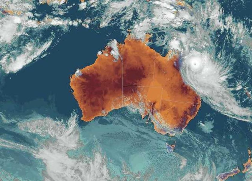
Info from HA7RY 0903072100UT
Internatioanal DX-pedition to Bajo Nuevo and Serrana Bank was a great success.
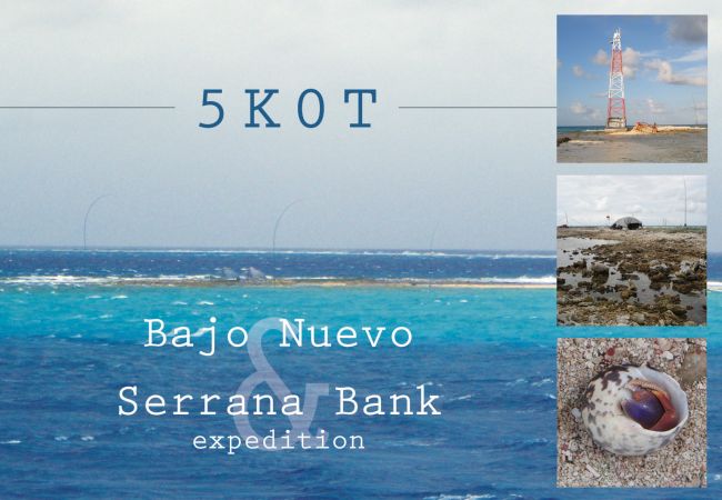
HA7RY the Hungarian member of the expedition just arrives home.
Their online log can be found at
You can see some pictures about the risky business here:
http://ha5pt.hamradio.hu/Bajo_Nuevo/thumb.html
| 5k0t Bajo Nuevo 006.jpg | Approaching Bajo Nuevo |
| 5k0t Bajo Nuevo 456.jpg | Antenna is about 30 meters from the tent at low tide. |
| 5k0t Bajo Nuevo 457.jpg | The energy source |
| 5k0t Bajo Nuevo 460.jpg | AA7JV in action. |
| 5k0t Bajo Nuevo 464.jpg | Pedro was blowing in the wind. |
| 5k0t Bajo Nuevo 469.jpg | Pedro was handling a big pile up. |
| 5k0t Bajo Nuevo 477.jpg | Water is not so friendly... |
| 5k0t Bajo Nuevo 485.jpg | This has been an international team operation. |
| 5k0t Bajo Nuevo 500.jpg | How comforable can be a tent in the high wind. |
| 5k0t Bajo Nuevo 510.jpg | Awakened to handle pile ups. |
| 5k0t Bajo Nuevo 517.jpg | Late in the night. |
They were operating C6AGU from 11th February till 5th March and 5K0T beginning with 14th November until 15th December 2008.
Info from HA7RY 0812141400UT
HA7TM's DXpeditions:
You can find online logs as well.
Palau Islands 2008. Nov. 22-Dec. 3.

FW5RE Wallis szigetek 2008. január 21. -február 21.
Website of the expedition:
http://www.ha0du.com/index.php
Egypt
21st November - 28th November, 2007. SU8BHI
The crew: HA3JB-Gabi, HA5FA-Jenci and HG5YFA-Erzsébet.
They plan to start on the 21st and to take part in the CQ WW DX CW Contest. Some SSB, RTTY and SSTV operations are probable before and after the contest.
73 de HA5FA Jenci
Lichtenstein DXpedition
The expedition was very succesfull , many nice comments on the cluster ...
5700 HF and 19 MS QSO
We have been using 6 antennas : INV-L for 160 m (12 radials , many W, 19 JA ... ) , inv-v dipole for 80m , monoband verticals for 40m and 20 meter , 3 bands trap vertical for 30/17/12 meter ( DunaX ) and 10 el DK7ZB for 2 meter ...
RIG: TS450SAT , FT840 , IC746 + 2 piece 4-500 Watts MOSFET PA for SW - bands...Please answer/comment to my home address : ha4xg@pannondxc.hu
73/DX de Geza , HA4XG
Pasman Island JN73QW
1st November to 5th November, 2007. IOTA EU170
The Pasman company consisted of a team of HA5KKC:
HA7CR Miki HA5AHX Pistike HA5LV Viktor HA5MA Laci
For more details visit
http://home.hu.inter.net/kviktor/
Thassos Island KN20in
24th October - 8th November, 2007
The team : HA2VR-Gyuszi, HA5OV-Péter, HA6NL-Laci, HA6PS-Zsolt, HA7JJS-Sanyi, HA6PL-Laci. Some facts: cca 25.000 Qs on HF and some on VHF. More than 3800 Qs on CQ-WW-SSB. Some 4000 Qs in HA-QRP Contest.. A detailed report can be found on http://www.radiovilag.hu/ 73s de HA6NL Laci
Willis Island DXpedition QH43xw
VK9WWI 22th Sept.-03th Oct. 2007
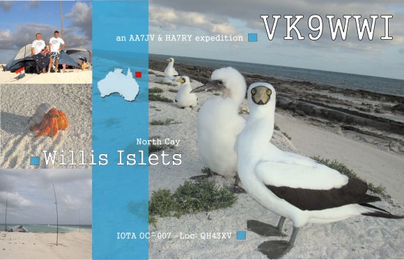
Blog and pictures from AA7JV George and HA7RY Tamas, in English and Hungarian language.
http://www.vk9wwi.hamradio.hu/
Korfu DXpedition
J48XG, September 2007.
Geza describes their adventureous trip on his webpage:
http://www.c3.hu/~ha0khw/j48xg.html
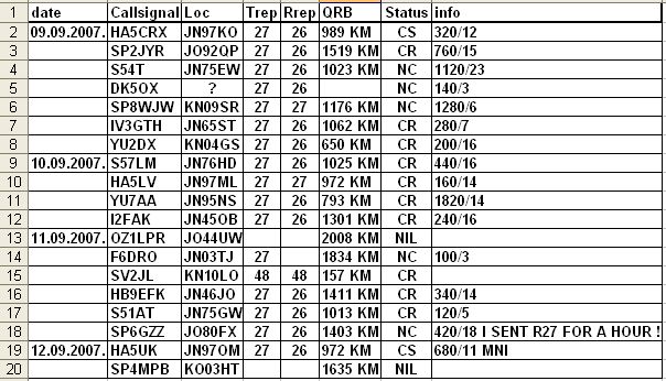
His meteorscatter log is as follows:
